McCroskey State Park – Sykline Drive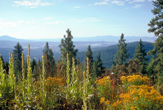
Farmington is the gateway to McCroskey State Park. The rugged terrain and breathtaking views in Mary McCroskey State Park are best suited for those with a sturdy vehicle and an adventurous spirit. Skyline Drive is an 18-mile long unimproved road that rises through dense cedar forest and ponderosa pines to spectacular vistas of the rolling Palouse prairie. The road provides access to 32 miles of multi-purpose trails for mountain bikers, hikers horseback riders and all-terrain vehicles (ATVs). The road is not safe for large RVs or trailers and it may be too rough for your family car, but if you’ve got a suitable rig and are willing to explore, you won’t be disappointed.
Pigeon Hollow – Indian Pathway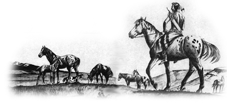
Indians made well defined trails in their many journeys. Sometimes by choice they went ‘over’ and not ‘around’. The higher ground provided dryer footing as well as advantages in seeing what was going on. The trail had to be chosen to divide into daily lots from one spring to another spring or creek. After the best route was found the Indians traveled the same path over and over again. All the pounding of moccasined feet and cayuse hoofs deepened the trail. Pioneer explorers often followed these thoroughfares finding them the best way to go. (One such trail traversed the area between Farmington and Skyline Drive.)
The surveyor made very plain the direction of the trail in Pigeon Hollow. He wrote in his notes,
“Between ranges 5 and 6 W., T. 44N, between sections 31 and 36 Indian trail bears southwest and northeast. Sandy hill slopes to the southwest.” It was an excellent trail. A long, easy walking, easy riding slope took the traveler from the valley floor to the summit of the mountains. Traffic over the trail was heavy and gave to Pigeon Hollow a rich and colorful history long before white men invaded the land.”
“Nez Perce Indians were the most frequent travelers over the trail. It was one of their routes for going to Montana to hunt buffalo…Nez Perce often went north to visit the Sacred Heart Mission…Both the Coeur d’Alene and Nez Perce (Nee-Me-Poo) people traveled north or south just to get together for fun and games.”
“New boundaries were established for the Coeur d’Alene Indian Reservation and the northern, eastern borders of Pigeon Hollow became the southern, western borders of the Reservation. Thereafter Indians regularly rode over the mountain and through Pigeon Hollow on their way to town. Farmington (Pine Creek) became their trading post. The Indians often rode home at night…The Coeur d’Alenes were friendly but sometimes their ways and their great curiosity disturbed the pioneers, especially the women.”
“How frustrated the Indians must have been when their trails were blocked by fences!”
(Excerpts from the book, Fields & Pine Trees by Opal Lambert Ross)
Steptoe Butte and Battlefield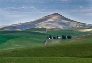
Steptoe Butte State Park is a 150-acre, 3,612-foot-tall natural monument. Thimble-shaped, the quartzite butte looms in bald grandeur over the prevailing flat lands.
The park is famous for its stark, dramatic beauty and the panoramic view it provides of surrounding farmlands, the Blue Mountains, and other neighboring ranges and peaks. From the top of the butte, the eye can see 200 miles.
Steptoe Butte was a reconnaissance point during the battle between the Indians and the US Army. Fought in May 1858 on Steptoe Battlefield, the battle was declared one of the last Native American victories in Washington Territory. In 1914, a 25′ memorial was erected to mark the authentic site of the battle. The Battlefield is located just out of Rosalia, WA, south end of Summit Ave. and borders the school ballfield.
Native Americans called Steptoe Butte “The Power Mountain”. It was believed that a journey to the Butte conferred a gift of power from the mountain’s guardian spirit.